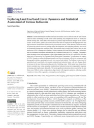
Exploring Land Use/Land Cover Dynamics and Statistical Assessment of Various Indicators

Current information on urban land use and surface cover is derived from the land classification of cities, facilitating accurate future urban planning. Key insights are driven by multi-year remote sensing data. These data, when analyzed, produce high-resolution changes on the Earth’s surface. In this context, publicly accessible Urban Atlas data are employed for the high-precision and high-resolution classification and monitoring of terrestrial surfaces. These datasets, which are useful for preserving natural resources, guiding spatial developments, and mitigating pollution, are crucial for monitoring changes and managing cities. This research aims to analyze and contrast land use and land cover (LULC) changes in Gaziantep (Turkey) between 2010 and 2018 using Urban Atlas data, and to investigate correlations between the city’s statistical data and LULC changes. Gaziantep’s urban dynamics were analyzed using Urban Atlas datasets from 2010 to 2015 and 2012 to 2018, the latter part of Copernicus, the European Earth Observation Programme. To understand the impact of LULC changes on urban landscapes, people, and the environment, official environmental and demographic statistics spanning four years were sourced and studied. The findings reveal a trend of agricultural and vacant lands evolving into residential and industrial zones, with such changes likely to increase in the near future, given the growth of building zones. While some land classes have shown consistent area values annually, residential and industrial zones have expanded in response to housing and employment demands. The most significant alterations have occurred in the last three years. Shifts in urban configurations align closely with migratory patterns, reflecting notable variations in factors like population, consumption, and pollution.

Erişime Açık
Görüntülenme
33
29.03.2024 tarihinden bu yana
İndirme
1
29.03.2024 tarihinden bu yana
Son Erişim Tarihi
04 Eylül 2024 15:13
Google Kontrol
Tıklayınız
Tam Metin
Tam Metin İndirmek için tıklayın Ön izleme
Detaylı Görünüm
Eser Adı
(dc.title)
Exploring Land Use/Land Cover Dynamics and Statistical Assessment of Various Indicators
Yazar
(dc.contributor.author)
Semih Sami Akay
Yayın Yılı
(dc.date.issued)
2024
Tür
(dc.type)
Makale
Özet
(dc.description.abstract)
Current information on urban land use and surface cover is derived from the land classification of cities, facilitating accurate future urban planning. Key insights are driven by multi-year remote sensing data. These data, when analyzed, produce high-resolution changes on the Earth’s surface. In this context, publicly accessible Urban Atlas data are employed for the high-precision and high-resolution classification and monitoring of terrestrial surfaces. These datasets, which are useful for preserving natural resources, guiding spatial developments, and mitigating pollution, are crucial for monitoring changes and managing cities. This research aims to analyze and contrast land use and land cover (LULC) changes in Gaziantep (Turkey) between 2010 and 2018 using Urban Atlas data, and to investigate correlations between the city’s statistical data and LULC changes. Gaziantep’s urban dynamics were analyzed using Urban Atlas datasets from 2010 to 2015 and 2012 to 2018, the latter part of Copernicus, the European Earth Observation Programme. To understand the impact of LULC changes on urban landscapes, people, and the environment, official environmental and demographic statistics spanning four years were sourced and studied. The findings reveal a trend of agricultural and vacant lands evolving into residential and industrial zones, with such changes likely to increase in the near future, given the growth of building zones. While some land classes have shown consistent area values annually, residential and industrial zones have expanded in response to housing and employment demands. The most significant alterations have occurred in the last three years. Shifts in urban configurations align closely with migratory patterns, reflecting notable variations in factors like population, consumption, and pollution.
Açık Erişim Tarihi
(dc.date.available)
2024-03-14
Yayıncı
(dc.publisher)
MDPI
Dil
(dc.language.iso)
En
Konu Başlıkları
(dc.subject)
Urban Atlas
Konu Başlıkları
(dc.subject)
LULC
Konu Başlıkları
(dc.subject)
Change detection
Konu Başlıkları
(dc.subject)
Urban mapping
Konu Başlıkları
(dc.subject)
Spatio-temporal statistic evaluation
Tek Biçim Adres
(dc.identifier.uri)
https://hdl.handle.net/20.500.14081/2021
Dergi
(dc.relation.journal)
Applied Sciences
Dergi Sayısı
(dc.identifier.issue)
6
Esere Katkı Sağlayan
(dc.contributor.other)
Akay, Semih Sami
DOI
(dc.identifier.doi)
https://doi.org/10.3390/app14062434
Orcid
(dc.identifier.orcid)
0000-0002-7367-8555
Dergi Cilt
(dc.identifier.volume)
14
wosquality
(dc.identifier.wosquality)
Q2
wosauthorid
(dc.contributor.wosauthorid)
AAB-1701-2022
Department
(dc.contributor.department)
Harita ve Kadastro Programı
Wos No
(dc.identifier.wos)
WOS:001191606100001
Veritabanları
(dc.source.platform)
Wos
Veritabanları
(dc.source.platform)
Scopus
Analizler
Yayın Görüntülenme
Yayın Görüntülenme
Erişilen ülkeler
Erişilen şehirler
6698 sayılı Kişisel Verilerin Korunması Kanunu kapsamında yükümlülüklerimiz ve çerez politikamız hakkında bilgi sahibi olmak için alttaki bağlantıyı kullanabilirsiniz.
Tamam

creativecommons
Bu site altında yer alan tüm kaynaklar Creative Commons Alıntı-GayriTicari-Türetilemez 4.0 Uluslararası Lisansı ile lisanslanmıştır.
Platforms